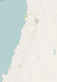
Hi-res Chile OpenStreetMap maps
The best way to see OpenStreetMap maps of Chile, is to just browse the map
For printing purposes though you may want an individual image at high resolution (very big). This image is 7168 x 10240 pixels. 6Mb PNG file covering a zoomed out area of Chile include the cities of Santiago and Concepción with the plain normal OpenStreetMap Mapnik style captured at zoom level 11.
>> Download chile.png (6 Mb) <<

More resources at 2010 Chile earthquake/Maps and data