![]() WhereCamp.EU was pretty mind-blowing. I wrote a few posts to the official site during the event:
WhereCamp.EU was pretty mind-blowing. I wrote a few posts to the official site during the event:
From a personal perspective it was massively enjoyable and rewarding, but the whole thing flew by too quickly. Preparations started months ago, but suddenly on the day there was so much to do, and at the same time so many people I wanted to chat to and fascinating sessions I wanted to see.
It got off to quite a blurry-eyed start due to geo-curry with the team the night before, followed by staying up late to prepare slides. As organisers we decided we would need to seed the unconference “wall” with some post-it notes in the first session slot, to get things going and spur other people to participate by setting an example. This meant I was feeling stressed and tired from the off, but it worked well, and despite a lot of people being new to the unconference style, a great atmosphere of participatory buzz carried the proceedings forwards at an alarming pace.
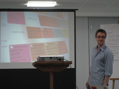
You can read more about my session “The State of the States in OpenStreet Map” on the WhereCamp.EU wiki
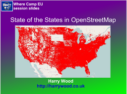
This got a pretty small audience because I was up against some awesome sessions from the other organisers, but I guess I’ll get the opportunity to re-use some of these slides on some other occasion. I might change the background colour. I’d had a few beers with the geo-curry, and the purple-green gradient seemed like a good idea.
I also contributed to the OpenStreetMap Q&A Session (mainly by asking the first question)
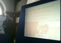
On the Saturday I ran another little session called “OpenStreetMap Practical – Never edited OpenStreetMap? Bring your laptop and we’ll show you how”, which kind of worked, although it clearly needed longer than the 15 minutes we had.
The event left me completely shattered, and I was quite surprised when I popped into the pub for a quick pint afterwards to be confronted by a massive crowd of geo-people all enthusiastically continuing the discussions.
I’ve just been checking out some blog responses and write-ups of the event: Gary Gale (vicchi.org) , Guardian Open Platform blog , Ed Parsons , Steven Feldman (giscussions) , jokru , Eamonn Neylon , James Cheshire (spatialanalysis.co.uk) As I say, from my perspective the whole thing flew past very quickly and it was quite difficult to know whether the event was actually going well, so it’s gratifying to know that people enjoyed it, and found the format successful.


 I’m going to be speaking at
