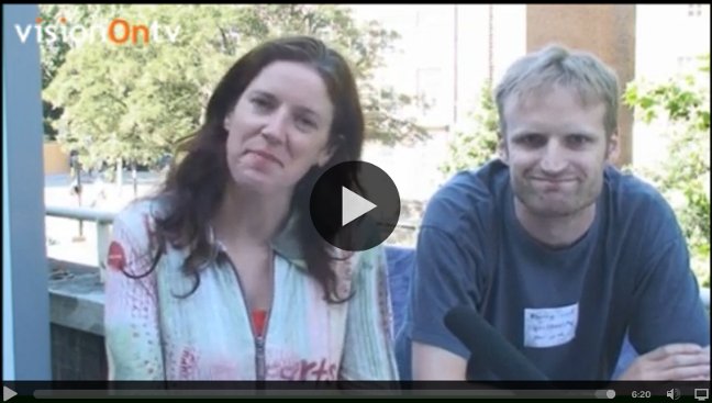
As well as giving a talk at OpenTech, I also did little interview about OpenStreetMap for VisionOn.TV:
It’s on youtube.
The “Documentation” link I mentioned is wiki.openstreetmap.org. Find out all about the OpenStreetMap project there.
The video featured here is an animation of OpenStreetMap edits back in 2008 (It’s stunning. Watch it full-res for the best effect) There’s even more worldwide editing activity on OpenStreetMap these days.
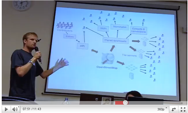
The talk I gave at OpenTech earlier in the day, is described in the previous blog post (also available as a video) That was going into more depth particularly for developers interested in using OpenStreetMap
Video
Thanks to the nice folk at VisionOn.tv for organising an interview in their “pop-up studio” there. VisionOn.TV is a pretty interesting citizen journalism project. Their approach was to do almost all their editing (e.g. dropping in the OSM animation video) “live” as they recorded the interview. This probably gives them a more fun live TV feel to their “studio” activities, but it also seems like a clever approach to avoid endless faffing with editing
…which is a big problem with creating video. I spent hours and hours on this tutorial video. The results were not really worth the time it took (That tutorial is now out-of-date for several reasons too) At the time I realised that I could have achieved almost as good a video by practising a few times and then recording the whole screencast in one take, rather than doing things piece by piece and editing clips together, which just takes forever.
I’m interested in this stuff because video is the way to reach out to the masses. Make stuff which appeals to the short attention span of the youtube generation. The Video approach is a no-brainer. The process of making video is difficult. For OpenStreetMap we need better promotional videos and video tutorials. Compare videos on that list, with the “guided tour” video (well flash animation actually) which is front and centre on waze.com . It’s a slick persuasive pitch to ordinary non-technical people (Important note: Don’t be persuaded! waze.com is one of several companies who get people to contribute geo-data, and then hoard it for their own commercial benefit. You should be supporting the not-for-profit OpenStreetMap project instead!)
This interview video is not a slick pitch. I’m concentrating on trying to explain OpenStreetMap in a persuasive way, and as a result I’m furrowing my brow and looking too serious. And when I first watched it back I thought I’d really failed to get various important messages across, particularly about the open data aspects of OpenStreetMap. But I guess that’s the short video way. Dumb things down and miss out the details. I feel better about it when I see a facebook comment from my (non-techie) sister saying “good explanation, I get it now!”.