Last Sunday I spent the whole day roller-blading around the streets of Wembley. I managed to get a sun tan (in October!) and it was the most exercise I’ve done in a long time. It’s taken about a week for my legs to stop aching.
It was the Wembley Mapping Party, a gathering of OpenStreetMap enthusiasts who were surveying the streets gathering street names, pubs, bus stops, post boxes, and other such details to go on a map.
Here’s my GPS trace
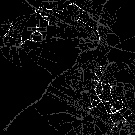
Notice the interesting circular loopy bit. That’s Wembley Stadium! I was also on personal mission to bag another stadium. I skated in a loop around the base of the building to get this GPS trace which I could then use to map it out reasonably accurately. OpenStreetMap did already have it, but the outline was drawn around yahoo aerial imagery which was out-of-date, showing the smaller previous stadium before it was rebuilt. The more circular footprint of the modern stadium should be showing up soon on openstreetmap (here)
This was a fun loop to draw by GPS, but most of the time the process of mapping out London is a bit more straightforward. We can rely on Yahoo! Aerial Imagery to give us a road layout, and so it’s mainly a matter of collecting street names (eliminating the orange unnamed streets) Anyone can get involved in that. It’s not too complicated. Create an account and try editing!
where did the name for walrond avenue arise & why
Walrond Avenue? I don’t know where the name came from. You live near there? Dave was cycling-mapping those streets last weekend.
Skating near Wembley stadium is always a great way to meet new people. Absolutely recommended!