Recently we celebrated one year of “Missing Maps” events. These humanitarian OpenStreetMap mapathon events have been very successful, packing out venues in London every time, with enthusiastic new mappers, who bring their laptops and perform remote armchair mapping of far off lands.
We’re successful at getting new mappers involved, and as we teach them, we drive up the quality of the basic data, and also help some of them to become quite advanced mappers (only some. That’s the long tail curve after all)
Meanwhile the OSMLondon pub meet-ups remain successful too in their own way. I’ve been organising them for years. Going back through the history of OpenStreetMap we’ve always had our merry band of OpenStreetMappers meeting in pubs, and doing London mapping.
I’m very keen to promote more cross-over. These newly recruited humanitarian mappers are yet learn about the joy of on-the-ground survey-based mapping. Mapping your own neighbourhood is the OpenStreetMap way. It seems like a vital missing piece of the puzzle really, if these new mappers are to truly integrate and be a part of the OpenStreetMap community.
So given a speaking slot at this special OSMGeoWeek Missing Maps event, I had a go at explaining those things… while also talking about pubs a lot! Here’s the slides and transcript of what I said, or intended to say.
Jump to slide:
1, 2, 3, 4, 5, 6, 7, 8, 9, 10, 11, 12, 13, 14
Slide 1
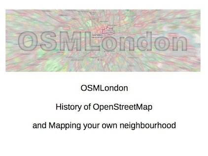
Pete Masters asked me to do a lightning talk about OSMLondon events. We have a little meet-up group for OpenStreetMap enthusiasts, with regular pub meet-ups. So that’s what this talk is. I’m going try to persuade you to come to the pub with me!
But actually I’ve put together a talk on a few other topics. All related, as I will explain: Some “history of OpenStreetMap”, and the idea of “mapping your own neighbourhood”
Slide 2
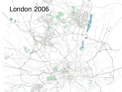
The OpenStreetMap project started here in London back in 2004. The community was just getting going with making maps by about 2006. The idea of OpenStreetMap (The wider OpenStreetMap project, not just the Humanitarian OpenStreetMap Team) is to create a map of the world and release it for free with an open license. So here we see the beginnings of that idea, and you can see we had a hopelessly patchy incomplete map. To make a free map of the entire world was a ridiculously audacious idea.
Slide 3
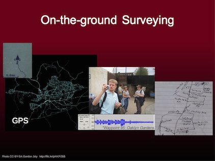
In the early days we experimented with all these different mapping techniques.
GPS was a key thing. Consumer GPS units were becoming really cheap, but people were looking for something interesting to do with them. By walking all the streets you can build a spiderweb-like picture which already looks a bit like a map.
Then there’s “photo mapping”, and “audio mapping”. Lots of fun with gadgets. But gathering data for OpenStreetMap can be as simple as using pen and paper.
This is all about on-the-ground surveying. Making a map by going out and exploring the world, and seeing things with your own eyes.
Slide 4
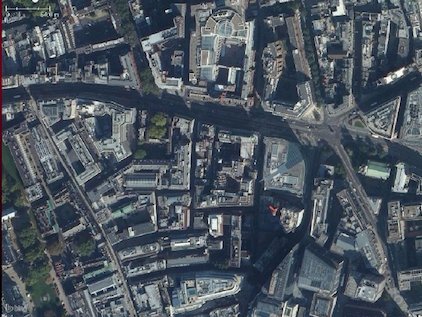
A few years later we got access to aerial imagery. This is the bing imagery here in London. You’ll notice it’s a lot more high-resolution than the imagery we’re normally seeing on these humanitarian tasks. In London we’re looking at photos from aeroplanes. In the developing world it’s usually a lot more fuzzy low-res, and coming from satellites.
In any case, having this imagery makes it a lot easier to make maps.
Slide 5
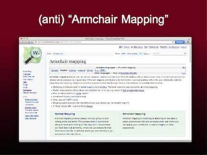
It even allows us to dispense with all of the previous mapping techniques and simply sit at home on our computers and trace things from imagery.
This is what we call “Armchair Mapping”. It’s actually a slightly disparaging term. There’s anti-armchair mapping sentiment in the wider OpenStreetMap community. It’s a lazy kind of mapping, sitting in your armchair blatting data quickly across a relatively large area, but with less quality and focus than an on-the-ground survey.
To be clear this is exactly the kind of mapping we’ve been teaching you to do at Missing Maps events, and it has its place for humanitarian work, but I want to talk to you about how we map London.
Slide 6
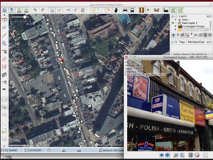
This is a pretty typical screenshot from my JOSM editor. I like to gather data by taking lots of photos on my iPhone. A couple of weeks ago I was out taking a photo of every shop down a high-street in Ilford, east London. Then using JOSM, I can see a photo icon in roughly the right location. Only roughly. We can see the accuracy of my phone’s GPS is limited. I can’t use the photo location to position the actual shop node exactly, but it’s an indication, and then I can use the imagery for better accuracy. But the idea is, I’m reading off the name and other details of the shop from the photo as I input this data into JOSM.
So that was a fairly big data gathering session, and then I have to spend quite a while inputting data when I get home.
Slide 7
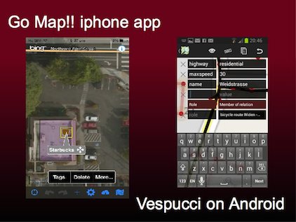
The other thing I do, is to use a mobile app to make edits while out and about.
I use “Go Map!!” on my iPhone. The equivalent on android is called “vespucci”.
This can be a lot easier for adding something quickly, but typing in tags (names of shops for example) with finger tapping is a bit slow. Not so good for a big mapping session
Slide 8
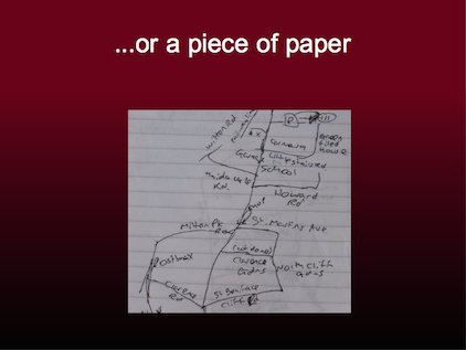
Don’t forget though, that it can be as simple as using a pen and paper.
Paper notes come in many forms. You may have come across fieldpapers.org printouts which use a clever QRcode.
But it could be just a simple note of a few names. The aim is simply to remember things until you get home to put the information on the map.
Slide 9
So this is how we have mapped London and the world. We’re working towards mapping more and more detail. The idea is to get lots and lots of people to all chip a little bit. If everyone just maps their own neighbourhood, then we can collaborate to map the whole world. You can see the different colours done by different people here.
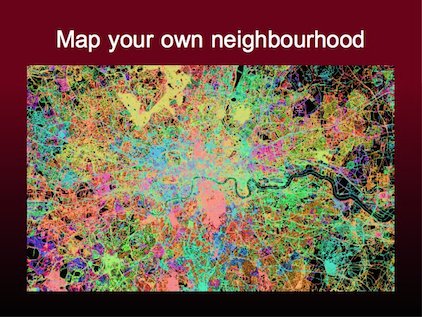
Slide 10
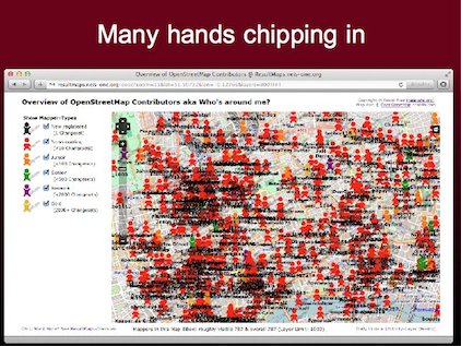
But perhaps this map shows it better. The oooc map shows lots and lots of people all chipping in a little bit. That’s all we need. Lots of people just contributing in a small way. Just mapping their neighbourhood.
Slide 11
So we’re here doing some remote mapping today, but I’d like to get you all interested in this idea. Not tonight, but some time soon, have a go at mapping your own neighbourhood!
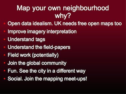
Why would you do this in somewhere like London, where there’s no humanitarian imperative? The main underlying reason is this idealistic open data idea. We’re building an open licensed map of the world. That’s a “good cause” in itself. We need that here in the UK and we’d like it to be a great map!
But here’s a few other reasons. Looking at buildings from above, can be confusing at times. I think it helps “get your eye in” working with imagery, if you go see roof shapes and alleyways in the real world, and then see them in the imagery. It will make you a better mapper.
You’ll also get better at other aspects of mapping. We don’t use many tags at Missing Maps meet-ups (Probably you’ve mostly been clicking building→building endlessly) When you map a row of shops, you’ll learn about all kinds of tags, dealing with classification challenges, maybe even inventing new tags. All good skills which will make you a better humanitarian mapper.
At the mid-month missing maps meet-ups, we’ve been showing “field papers” to the more advanced mappers. It’s notes written on paper by people in Bangladesh for example. These are very difficult to interpret, but they will start to make a bit more sense if you have experience of making these kind of notes yourself.
And, I don’t want to make any promises, but you could even find yourself being sent to do humanitarian field work! We’re building a roster of people who might be able to do this, and have the required skills. But it requires understanding OpenStreetMap from end-to-end, particularly the on-the-ground surveying side of things, how to work around device issues etc. These skills are in demand!
But here are the main reasons for mapping your own neighbourhood: You’re joining the global OpenStreetMap community. People all around the globe are mapping their own neighbourhood! They’re all passionate about it. And it’s fun! You’ll see the city a different way. When I go shopping with my wife, she’ll be looking what’s on sale, and I’ll be looking at the address numbers, and choosing a tag classification for each shop!
…and it’s all a good excuse to meet other OpenStreetMappers in the pub, which brings me back to the OSMLondon topic
Slide 12
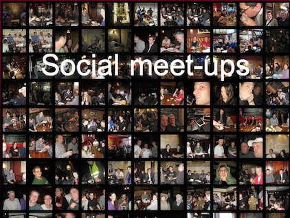
Every couple of weeks we have an OSMLondon pub meet-up. They are much smaller than these Missing Maps events. Just a bunch of between 5 and 15 people in a pub, having beers and friendly chats about all things OpenStreetMap!
Slide 13
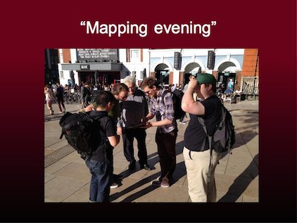
We do also do “mapping evenings”. This is one from the summer time last year when we went mapping in Brixton together. We introduce new people and give a mapping demonstration as a group, or we all split up. We have a “cake diagram” and all map a slice of the cake. Usually we just do this for an hour …and then we go to the pub.
During the winter though we don’t generally have many of these. We just go direct to the pub
Slide 14
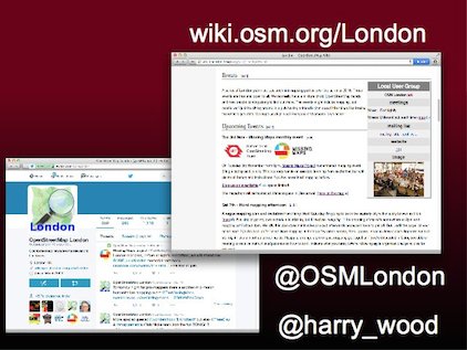
So here’s how to find out about these events. I try to list all the London OpenStreetMap events including these Missing Maps events, on the ‘London’ page of the OpenStreetMap wiki.
And follow @OSMLondon on twitter
Thank you!
Jump to slide:
1, 2, 3, 4, 5, 6, 7, 8, 9, 10, 11, 12, 13, 14
FYI The next London pub meet-up is now scheduled. We’ll be in the Parcel Yard pub this coming Thursday! (details)