I presented a workshop (or at least a live demo session) at the
Society Of Cartographers conference with the rather vague open ended title of “Using OpenStreetMap Data”
– “A tour of the various options for downloading and otherwise accessing OpenStreetMap data from a geo-data user’s perspective. Harry Wood will explain how to delve into the raw data structures using tools on the website and elsewhere, how to explore the wiki-style editing history, how OpenStreetMap’s unique ‘tags’ approach works, and some ways of manipulating the map data.” At least that’s what I wanted it to be. It didn’t go entirely to plan (see apologies below)
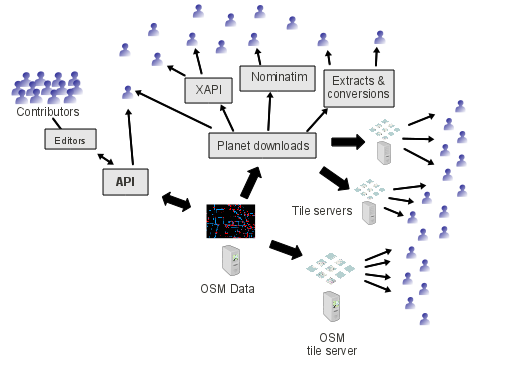
I started by presenting some slides from my OpenTech OpenStreetMap developer ecosystem presentation which highlights the central role of raw geodata, and gradually builds up a picture culminating in this diagram (see above link for the full build-up and explanation)

Also a re-use of the slide explaining different levels of OpenStreetMap use which developers and data user organisations might consider.
Then it was on to the live demos touring around various different topics and tools. I don’t think I actually timed it well enough to get through all these things in either of the two hour-long sessions, but the following were Continue reading “Workshop on Using OpenStreetMap Data” →

