[Update: They’ve now hired a rails developer. Thanks for the responses! Still opportunities to help I’m sure. I will to try post an update on how to get involved]
I wanted to help promote this Ruby on Rails developer job at OpenCity which I think will be a really interesting thing for somebody, maybe a junior rails developer. Know anyone?
If you’re a londoner you’ve probably heard of “Open House” an event taking place each year where, for one day, you can take a look around lots of interesting buildings, for free, which are often closed to the public the rest of the time.
The Open House event is put together by a not-for-profit organisation called OpenCity, in their office near Aldgate. From there they organise this annual architectural bonanaza, coordinating hundreds of people (volunteers and building owners) with lots of careful planning …and some IT challenges.
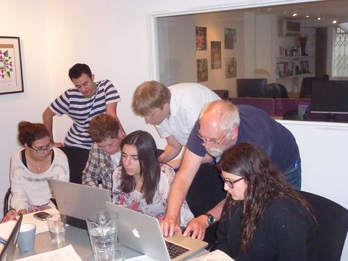
Being an interesting and fun not-for-profit organisation, I have ended up volunteering a bit of my time with them. Me and another volunteer have been planning a rebuild of a database system they’re using internally, which will later ripple up to some cool improvements on their public facing website.
To me this looks like a juicy challenge and a fun organisation to be helping out, so I’m hoping we can find a suitable available developer who feels the same! I’m not available myself, except in my spare time. I plan to be dipping in on this project from time-to-time, so I would be working with this person a little bit.
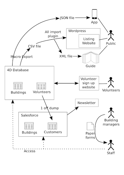
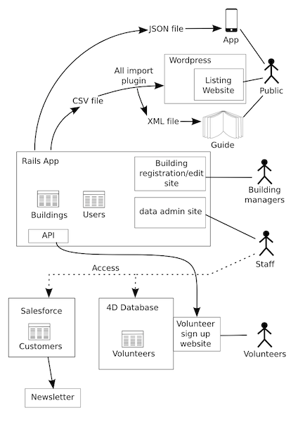
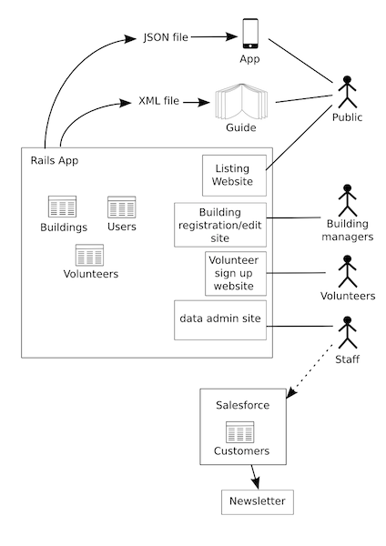
The project planning is at a very early stage, but I’ve been drawing the above diagrams which show… (left-to-right)
- Their current set-up
- An initial milestone introducing a rails app for their buildings database
- And a final situation with websites and database consolidated
Hopefully in the end we will have managed to consolidate things and four different websites (or four different user journeys/permission levels within the same website) will be served by a lovely new rails app!
OpenCity are very open to our ideas, and one thing we’ve suggested, is to do this whole thing open source on github, as a way of being open to contribution from any other developers who fancy helping this organisation, but this is a pretty big job which will need somebody on it full time. Hopefully quite an interesting challenge for somebody! Please pass this on to anyone who might be interested.


 Lineup Puzzle