#geomob presentation on HOT

Last week I gave a talk at #geomob, London’s second most important geo meet-up group (after OSMLondon of course). It was good to be able to get up and present something after watching so many others over the past couple of years.

My talk was about the Humanitarian OpenStreetMap Team (hot.openstreetmap.org) I’ve been doing a fair bit of HOT stuff lately, so it came at a good time. I’ve just got back from a week long trip to Washington D.C. for a board strategy meeting, followed by various events there. The talk is a refresh and update of previous talks I’ve given on the topic, plus some new info inspired by this recent trip (newer stuff from slide 18 onwards)

Download slides for OpenOffice (28Mb!)

…or just see them below with notes (kind of a transcript) alongside:


Slide 1

I’m going to talk about the Humanitarian OpenStreetMap Team. How OpenStreetMap offers a great platform for humanitarian mapping, and a look at some of the Continue reading “#geomob presentation on HOT”

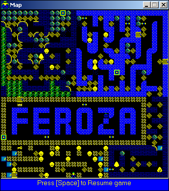
Some new repton3 maps

Peter McElwee emailed me saying “Thanks for releasing Repton 3, have lots of fun but the wife isn’t so pleased. Anyway have made two levels of my own, would be great to have your comments”

So you can now download his ‘names.rls’ levelset file.

<sarcasm> Repton3 is a fast moving sector of the games industry. The game was released in 1985 for the BBC micro and electron. I made my repton3 version for windows in 1998, just 14 years later. Gamers the world over set to work proving their puzzle solving prowess by conquering my two levelsets as quickly as they could, and sure enough in 2000 my mate Will succeeded, followed by two more people in 2006 (hot on his heels!) I also made a level editor, knowing that this would send gamers into a frenzy as they they start designing levels and emailing me with files to share. Sure enough in January 2011 Peter sent me this names.rls file, and so I didn’t waste a second to publish this on my website 14 months later.

but seriously </sarcasm> it is actually quite exciting for me to receive some repton3 puzzles from somebody else. Thank you Peter, and massive apologies for failing to do anything with your email for the past 14 months! I sort of forgot about it because repton3 is languishing on my under-used windows machine these days. But actually the real reason was, I wanted to play through your maps myself, and then reply saying they were too easy…  but then I got a bit stuck! I have now played them though. Good fun playing other people’s repton puzzles!

Giving up twitter for lent

I’ve decided to give up Twitter and IRC for 40 days and 40 nights. This is quite a big deal for me. It remains to be seen how well it works, but I’ve survived the first couple of days. @harry_wood has gone quiet!

Somehow twitter has become very entwined in how I operate. I use it to keep up to date with news and interact with a “professional network” and “friend” type people within various spheres: OpenStreetMap, open data particularly transport data, general IT tech & mobile/web. Reading, interacting, announcing and microblogging on these topics. And it’s great. I’m hooked on it and I’m happy with it, but…

I’m anticipating some possible positive effects of giving it up for the next 40 days and 40 nights.

Maybe I’ll blog more. Somehow twitter uses up a lot of the creative energy that previously would have gone into writing blog posts. I know I’m not the only one to more or less stop blogging as I embraced twitter. There’s a few things I really should have blogged about but lately I’ve just been using my blog for publishing presentation slides. So more to come here hopefully.

These days twitter replaces RSS for many people. It’s normal to tweet with a link to your blog every time you post. Should I allow myself this? I think not. I’m going cold-turkey on this one! Who knows, maybe somebody else might tweet a link to here. Or maybe nobody will read this 🙁   As usual, if you say “hi” in the comments it will make me happy. If you don’t, then I’ll just brood about whether or not I have a signficant number of lurkers.
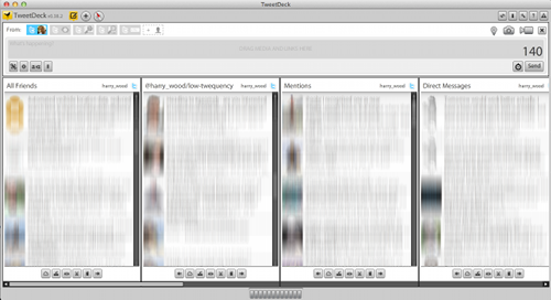
The other positive effect will be eliminating the time sink that twitter represents. Although twitter is a neat way to distil things and the signal to noise ratio isn’t too bad (otherwise I wouldn’t use it) I can’t deny that it is often just a tempting distraction. One click of that juicey looking tweetdeck icon and I can marvel with a dizzying feeling as technology and society and all manner of fun seredipidous nonsense spins before my eyes, and… oh yes I was supposed to be doing some work.

I’ll be quitting IRC too (Chatrooms for those who don’t know) The mac Adium IRC client lets me auto-join all my favourite OpenStreetMap channels, and then the cute little green duck flaps its wings when someone wants to chat to me. How can I not click on a cute flapping green duck?? I won’t go completely cold turkey on this, because I have some meetings I need to attend, but over lent the duck will die.

I imagine I may move onto facebook and google+ to get my fix of realtime updates. I’ll allow myself this because I see it as another positive. I feel I should try to understand google+ better. After the failure ot orkut, buzz, and wave, it seems google are going to shove this one down our throats via their search results, so perhaps there will be no escaping how important it will be for promoting things. Meanwhile facebook is where all my non-techy friends hang out. I should stay in touch with them better. Also it’s easy to forget that facebook is much more mainstream than twitter, so promoting on facebook has more potential reach, if you can get your message right (and non-techy enough). It can well be argued that twitter is a terrible echo-chambre. A community of people all re-tweeting eachother, stroking eachother’s egos, whilst forgetting that there’s a big world out there beyond. I don’t really think that, twitter friends, but I sometimes wonder.

Well for 40 days and nights I am severing my connection to the hive. Wish me luck!

Oh and if you’re wondering how to reach me, drop me an email. Yeah one of those old things. If you limit it to 140 characters I’ll probably find that comforting in some way.

My SOTM11 talk

We had the annual “State of the map” OpenStreetMap conference a month ago. This was in Denver. I had a choice between this or the more sensible carbon-efficient location of Vienna for SOTM-EU a few months earlier. I decided to go to Denver. To be honest I sort of drifted into that decision in a disorganised manner, but I did have some reasons as I said at the time.

I knew there was a core of London OSMers who were deciding to go to SOTMEU, and not to Denver. I felt it might be important to be in Denver as a representative, to meet, explain, and be an ambassador for the heart and soul of OpenStreetMap. The “OpenStreetMap way” as I see it. This is what I tried to do with my talk: “Blossoms, weeds and blades of grass: Growing the map”

The following is all the slides and a transcript of roughly what I said (or intended to say) It’s a bit of a whopper. Sorry if your RSS reader just blew a fuse. Alternatively you can watch this as a video showing slides and good quality audio, or a live action video from the front (but not so good audio). You can also see the slides on slideshare, download for OpenOffice, or powerpoint (32 MB).


Slide 1

I’m Harry and I’m from England… and I thought I’d compare OpenStreetMap to an english country garden.

It sort of blossoms with a wondrous variety of Continue reading “My SOTM11 talk”

Society of Cartographers Plymouth


A couple of weeks ago I was in Plymouth for the Society of Cartographers Annual Conference. Lots of interesting talks and a fun and friendly atmosphere, particularly during the evening entertainment: pub quiz, boat trip and rum cocktails. [update: forgot to say my photos from the conference are here]

I came across a strange new breed of people who knew all about making maps using only adobe illustrator. That’s a side of “cartography” which rarely surfaces at the geo events I’ve been to before (and I’ve been to quite a few now), but this seems like a rather interesting artistic end of a map-making spectrum. I didn’t come across anyone who had tried out OpenStreetMaps options for exporting to Illustrator. This probably needs to be made easier, but I suspect Maperative might be a kick ass tool in this arena. I don’t have illustrator myself, so I’d be interested to know how well it works.

I gave a talk on a blend of topics to do with transport and open data and some of my experience of mobile geo development. I talked through some stuff I’ve been working on at placr.co.uk: The UK Travel Options iPhone app, and the more recent placr.mobi mobile website. Then I gave a few more nice bits of bus route related technology (and cartography) coming out of OpenStreetMap.

The slides and notes (approximately what I said in the talk) are included with the presentation on slideshare, or OpenOffice download, or PowerPoint download …or here it all is in good old pictures & text:


Slide 0


I’ve got four different things I want to talk about.

I want to talk about Open Data, and specifically Open Transport Data. And I want to talk about the work I’ve been doing at placr.co.uk, and finally my hobby and passion OpenStreetMap.

Lots to cover, but fortunately they’re all wonderfully interrelated, so it’s really just one big topic.

Continue reading “Society of Cartographers Plymouth”

Humanitarian OpenStreetMap Team talk for Article25

Last week I gave a talk about humanitarian mapping with OpenStreetMap. This was at an event organised by Article25, sponge network, and RIBA knowledge communities.

Download slides as an OpenOffice .odp file

Slides on slideshare.net

Or here are the slides as plain old images and slide notes alongside:


I’m going to talk about mapping as in creating maps, and the not-for-profit mass-collaboration project “OpenStreetMap”. I’ll show various examples of how OpenStreetMap has helped in disaster response and developing world situations.

But first let me explain what OpenStreetMap is…


OpenStreetMap.org is a website which displays a map. Here is a map of where we are right now for example. The site lets you zoom in and pan around the map, much like google maps. But you can already see some interesting details which you wouldn’t get with google maps.

OpenStreetMap is much more than just a map…

Continue reading “Humanitarian OpenStreetMap Team talk for Article25”

32nd Birthday

A few years ago I had thought (with some sadness) that I didn’t really know how to get completely drunk any more. I could tolerate quite a lot of beer, and I formed a very grown up and very boring habit of slowing down when I felt myself getting drunk (or full of bubbles). Lately I have an even more boring habit of drinking less often. But on the plus side this has turned me into a total lightweight, so happily on my 32nd birthday party I was able to get utterly sozzled again, just like the old days.

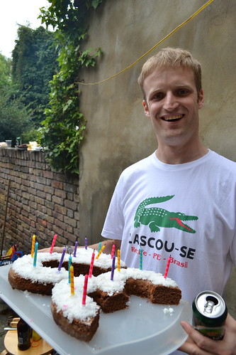
32nd birthday

Thanks to everyone who came along to my birthday BBQ last weekend.

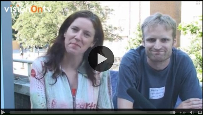
VisionOn.TV OpenStreetMap interview

As well as giving a talk at OpenTech, I also did little interview about OpenStreetMap for VisionOn.TV:

visionontv-interview-frame.jpg

It’s on youtube.

The “Documentation” link I mentioned is wiki.openstreetmap.org. Find out all about the OpenStreetMap project there.

The video featured here is an animation of OpenStreetMap edits back in 2008 (It’s stunning. Watch it full-res for the best effect) There’s even more worldwide editing activity on OpenStreetMap these days.

The talk I gave at OpenTech earlier in the day, is described in the previous blog post (also available as a video) That was going into more depth particularly for developers interested in using OpenStreetMap

Video

Thanks to the nice folk at VisionOn.tv for organising an interview in their “pop-up studio” there. VisionOn.TV is a pretty interesting citizen journalism project. Their approach was to do almost all their editing (e.g. dropping in the OSM animation video) “live” as they recorded the interview. This probably gives them a more fun live TV feel to their “studio” activities, but it also seems like a clever approach to avoid endless faffing with editing

…which is a big problem with creating video. I spent hours and hours on this tutorial video. The results were not really worth the time it took (That tutorial is now out-of-date for several reasons too) At the time I realised that I could have achieved almost as good a video by practising a few times and then recording the whole screencast in one take, rather than doing things piece by piece and editing clips together, which just takes forever.

I’m interested in this stuff because video is the way to reach out to the masses. Make stuff which appeals to the short attention span of the youtube generation. The Video approach is a no-brainer. The process of making video is difficult. For OpenStreetMap we need better promotional videos and video tutorials. Compare videos on that list, with the “guided tour” video (well flash animation actually) which is front and centre on waze.com . It’s a slick persuasive pitch to ordinary non-technical people (Important note: Don’t be persuaded! waze.com is one of several companies who get people to contribute geo-data, and then hoard it for their own commercial benefit. You should be supporting the not-for-profit OpenStreetMap project instead!)

This interview video is not a slick pitch. I’m concentrating on trying to explain OpenStreetMap in a persuasive way, and as a result I’m furrowing my brow and looking too serious. And when I first watched it back I thought I’d really failed to get various important messages across, particularly about the open data aspects of OpenStreetMap. But I guess that’s the short video way. Dumb things down and miss out the details. I feel better about it when I see a facebook comment from my (non-techie) sister saying “good explanation, I get it now!”.

OpenStreetMap at OpenTech 2011

I gave a talk at OpenTech 2011 yesterday. This is a big open source open data London technology conference. A lot of fun.

I gave an overview of the developer ecosystem around OpenStreetMap data, how web and mobile app developers can use OpenStreetMap, and how the OpenStreetMap tile server is only a small part of that. This included a whole sequence of shiny new slides to illustrate these points by gradually building up a nice diagram.

Watch the talk video on youtube

Slides on SlideShare.net

The session listing on lanyrd has some photos etc linked from there.

The following is the slides in a form which is less likely to crash your browser, along with notes


Open Technology enthusiasts will have heard of OpenStreetMap before


If you’ve only taken a quick look, you’ll perhaps have the idea that OpenStreetMap is an open source competitor to Google maps. It kind of is that, but that’s not really the whole story.


It’s more accurate to compare OpenStreetMap with wikipedia. It is very much the wikipedia of maps. Similar for a number of reasons….

Continue reading “OpenStreetMap at OpenTech 2011”

London Silicon Roundabout meet-up

I went along to a “London Silicon Roundabout meet-up” last week. It’s a very dragons den style business pitching sort of event, both in the presentations later on, and in the kind of conversations people were having while socialising beforehand. I did my best to describe placr.co.uk to a few people, but I shall have to polish my pitch a little. The various projects we have on the go at the moment, make for a rather confusing story. I probably should’ve stuck to describing our iPhone app ‘UK TravelOptions’.

After the socialising with beers on the roof terrace, there was a more formal sit-down presentation session. I think the presenters were told they had five minutes and then given 15/20 minutes. ~100 people in the audience. Some were real investors. Many, like me, were just enjoying playing the role, imagining ourselves to be investors. Lots of chin scratching and awkward questions being asked. These were the presentations and some of my thoughts on them:


blottr.com – User generated news site a.k.a. citizen journalism. Well presented. They have algorithms for deciding if content is unconfirmed vs credible (which he over-egged the sophistication of). Also rating mood of an article on a percentage level. This idea reminded me a lot of zapidonia.com (ancient history). But I mainly found it interesting that they’d gone for localised city-based news sites. He didn’t really explain why.

kliqed.com – iPhone app for meeting up with friends. Meetings are auto-arranged matching by location (a geo app!) and also by your free time calendar. They’re building their own more exclusive friends network. Just your close friends, rather than hooking into twitter and facebook networks. It was a slick presentation, but it’s doomed to fail. There’s a huge critical mass challenge with that idea, worse, a “geo-critical-mass” challenge. This has killed many other “find friends nearby” app ideas which have gone before it.

freelancestudents.co.uk – I wanted this to be a good pitch. The idea is obvious from the name, and it’s a good one. As a student I was bristling with untapped computer programming enthusiasm, and a need to earn some peanuts, but no obvious gateway into casual part-time skilled job. Companies (as far as I could tell at the time) were only looking for full time graduates. And yet since then I’ve come across countless situations where I’ve thought “surely we could hire a student to do this fun bit of website coding”. Sadly the pitch scored a big FAIL because he didn’t show the actual website! Also his claim of quality (of freelancers) was not backed up with a convincing explanation.

zuztertu.com – eductional mobile app. Presenting educational content and testing interfaces within a mobile app, but also a platform for creation of content. It was clear they’d engaged with school teachers and academics, and figured out clever ways of letting them, or persuading them, to do simple content authoring for mobile screens. This was my favourite talk. Education is a fun software genre. Mobile education is going to be big. I wonder if john mckerrel’s examtutor apps were one of the competitors they’d checked out. I’m sure my android app will be if I ever release it 🙂

Tag Bento – tagging of objects in photos. Didn’t really understand the idea of this one. Photos of products. e.g. make-up bag spread out on a table. These were ‘tagged’ with linkified areas of the photos taking you to sites for purchasing them. Users could create these object tagged product photos, but it wasn’t clear why.

“I’ll tell you where I am… I’m out”